
CHL Model Image
Sediment Budget Analysis System (SBAS)
Model Category
Description
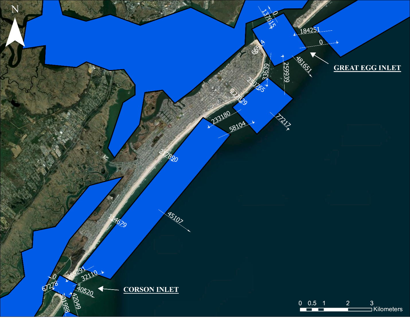
The Sediment Budget Analysis System (SBAS) is an ArcGIS toolbox for creating and visualizing sediment budgets. Sediment budgets provide a conceptual a
CHL Model Image
Model Category
Description
The Sediment Budget Analysis System (SBAS) is an ArcGIS toolbox for creating and visualizing sediment budgets. Sediment budgets provide a conceptual a
CHL Model Image
GenCade - A Regional Shoreline Evolution Model
Model Category
Description
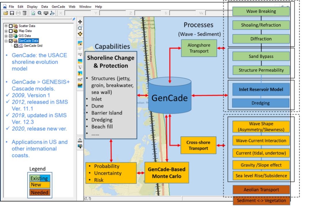
GenCade is a one-line shoreline simulation model that combines the capabilities of regional-scale, planning-level calculations of the Cascade model an
CHL Model Image
Model Category
Description
GenCade is a one-line shoreline simulation model that combines the capabilities of regional-scale, planning-level calculations of the Cascade model an