
CHL Model Image
Sediment Budget Analysis System (SBAS)
Model Category
Description
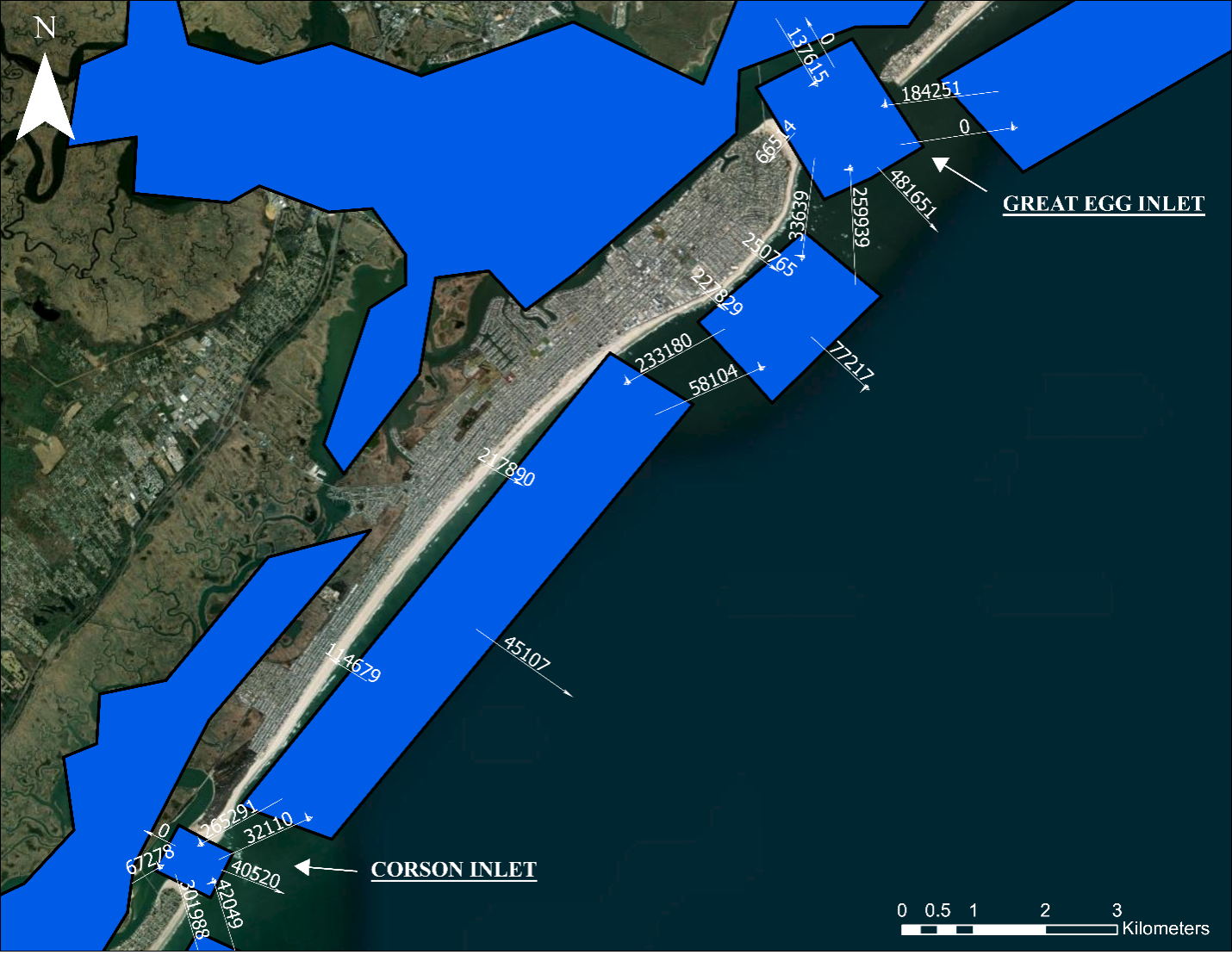
The Sediment Budget Analysis System (SBAS) is an ArcGIS toolbox for creating and visualizing sediment budgets. Sediment budgets provide a conceptual a
CHL Model Image
Model Category
Description
The Sediment Budget Analysis System (SBAS) is an ArcGIS toolbox for creating and visualizing sediment budgets. Sediment budgets provide a conceptual a
CHL Model Image
GenCade - A Regional Shoreline Evolution Model
Model Category
Description
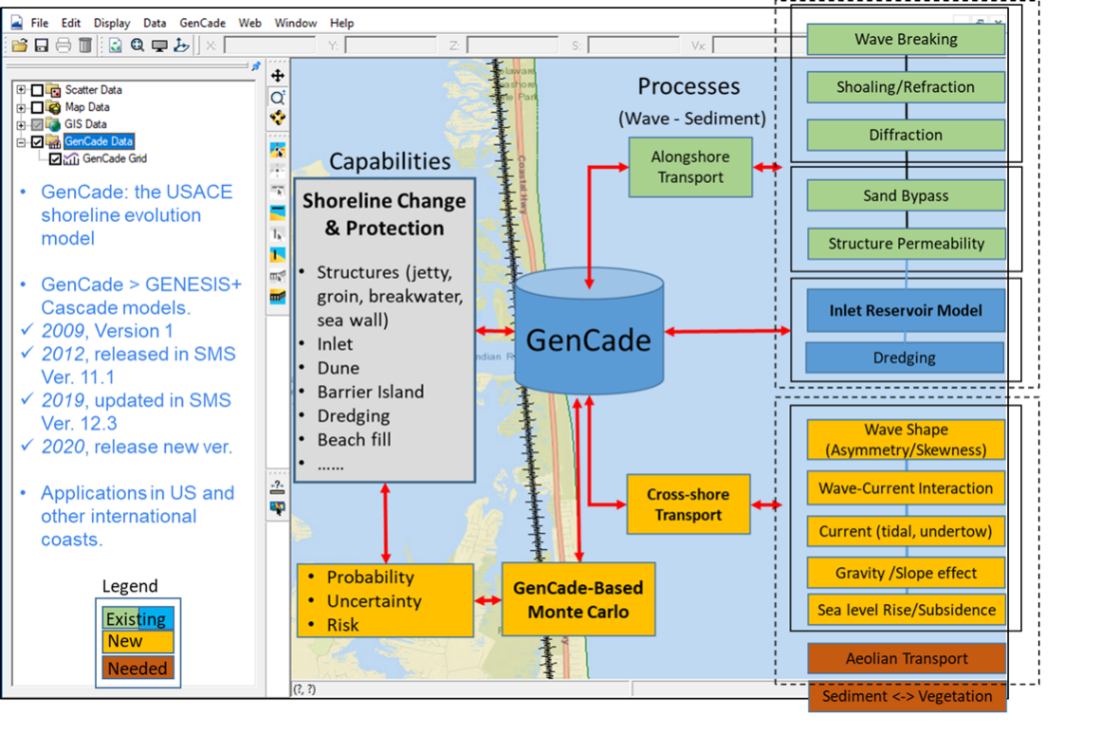
GenCade is a one-line shoreline simulation model that combines the capabilities of regional-scale, planning-level calculations of the Cascade model an
CHL Model Image
Model Category
Description
GenCade is a one-line shoreline simulation model that combines the capabilities of regional-scale, planning-level calculations of the Cascade model an
CHL Model Image
Particle Tracking Model (PTM)
Model Category
Description
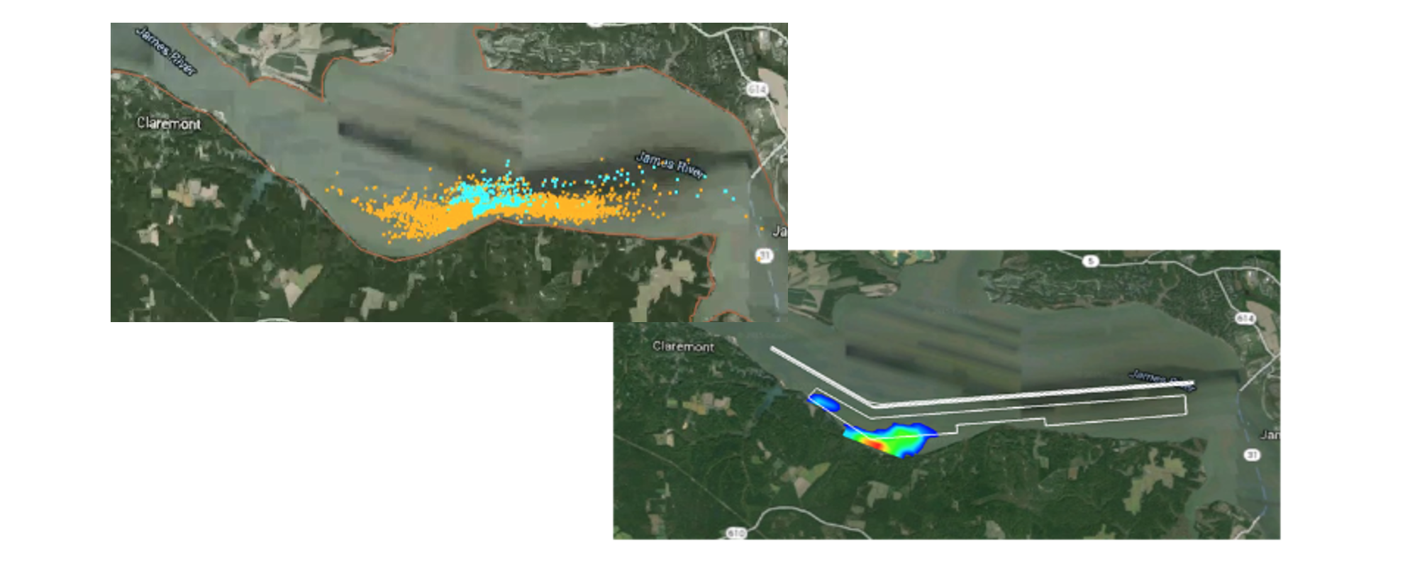
The Particle Tracking Model (PTM) is a Lagrangian particle tracker designed to allow the user to simulate particle transport processes. PTM has been d
CHL Model Image
Model Category
Description
The Particle Tracking Model (PTM) is a Lagrangian particle tracker designed to allow the user to simulate particle transport processes. PTM has been d
CHL Model Image
Continuous Discharge Fates (CDFATE)
Model Category
Description
The CDFATE model simulates jet dynamics and entrainment of initial discharge, density driven spreading, passive transport and turbulent diffusion of a
CHL Model Image
Model Category
Description
The CDFATE model simulates jet dynamics and entrainment of initial discharge, density driven spreading, passive transport and turbulent diffusion of a
CHL Model Image
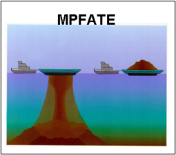
Multiple Placement FATE of dredged material placed in open water (MPFATE)
Model Category
Description
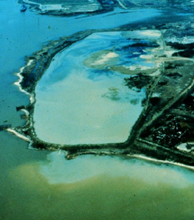
MPFATE is the Multiple Placement FATE of dredged material in open water model. MPFATE represents the accumulation of sediment resulting from multiple
CHL Model Image
Model Category
Description
MPFATE is the Multiple Placement FATE of dredged material in open water model. MPFATE represents the accumulation of sediment resulting from multiple
CHL Model Image
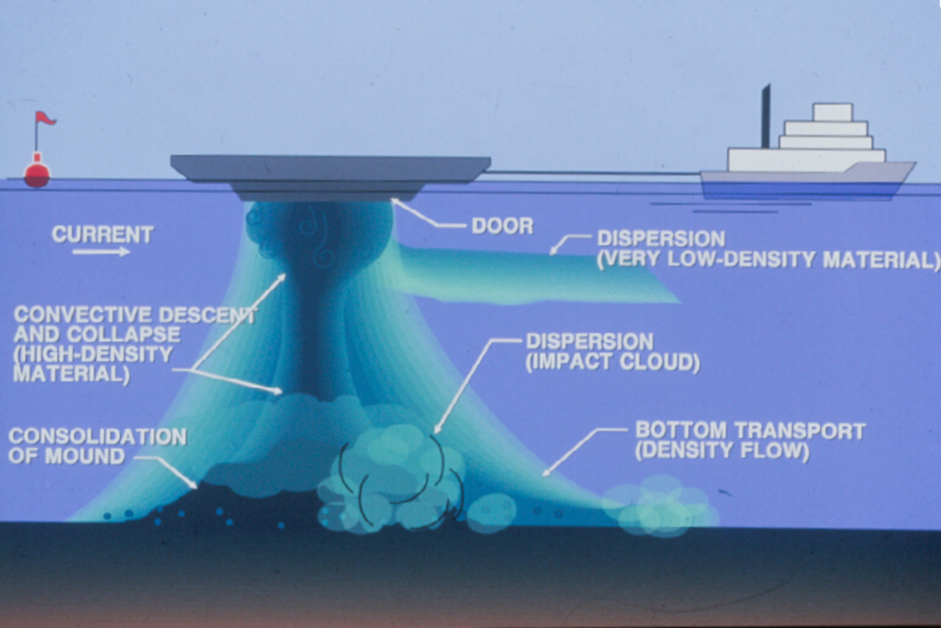
Short-Term FATE of dredged material placed in open water (STFATE)
Model Category
Description
The STFATE model simulates the short-term fate of dredged material discharged from a barge/dump scow or hopper dredge in open water. The model predic
CHL Model Image
Model Category
Description
The STFATE model simulates the short-term fate of dredged material discharged from a barge/dump scow or hopper dredge in open water. The model predic