
CHL Model Image
Coastal Hazards System (CHS)
Model Category
Description
The Coastal Hazards System (CHS) (https://chs.erdc.dren.mil) is a national-scale, multi-agency initiative for quantifying coastal hazards from hurrica
CHL Model Image
Model Category
Description
The Coastal Hazards System (CHS) (https://chs.erdc.dren.mil) is a national-scale, multi-agency initiative for quantifying coastal hazards from hurrica
CHL Model Image

Wave Information Study (WIS)
Model Category
Description
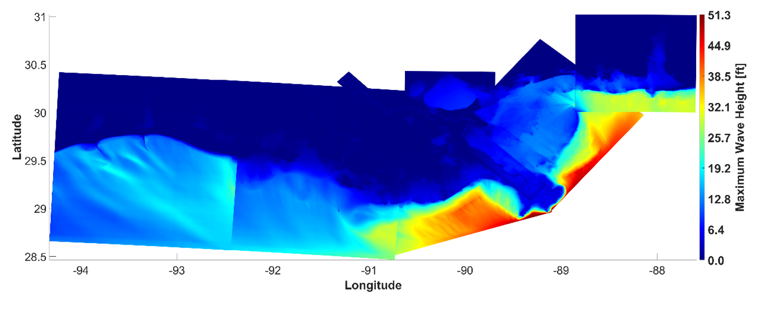
The Wave Information Study (WIS) is a global hindcast system that focuses on delivering high-quality coastal wave estimates, wave analyzes products, a
CHL Model Image
Model Category
Description
The Wave Information Study (WIS) is a global hindcast system that focuses on delivering high-quality coastal wave estimates, wave analyzes products, a
CHL Model Image
STeady-state spectral WAVE (STWAVE)
Model Category
Description
The STeady-state spectral WAVE model (STWAVE) is a numerical model for simulating nearshore wind-wave growth, propagation, and transformation along op
CHL Model Image
Model Category
Description
The STeady-state spectral WAVE model (STWAVE) is a numerical model for simulating nearshore wind-wave growth, propagation, and transformation along op
CHL Model Image

Surface-water Modeling System (SMS)
Description
The Surface-water Modeling System (SMS), developed by Aquaveo, LLC, gives users access to a full range of coastal and riverine solutions. It provides
CHL Model Image
Model Category
Description
The Surface-water Modeling System (SMS), developed by Aquaveo, LLC, gives users access to a full range of coastal and riverine solutions. It provides
CHL Model Image

Generation 2 Coastal Risk Model (G2CRM)
Model Category
Description
G2CRM is a probabilistic life cycle analysis model for evaluating performance and economic benefits of inundation prevention measures for coastal stor
CHL Model Image
Model Category
Description
G2CRM is a probabilistic life cycle analysis model for evaluating performance and economic benefits of inundation prevention measures for coastal stor
CHL Model Image
Beach-fx
Model Category
Description
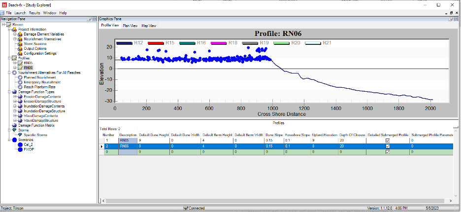
Beach-fx is a probabilistic life cycle analysis model for evaluating performance and economic benefits of beach nourishment projects on sandy coastlin
CHL Model Image
Model Category
Description
Beach-fx is a probabilistic life cycle analysis model for evaluating performance and economic benefits of beach nourishment projects on sandy coastlin