
CHL Model Image
Advanced Circulation (ADCIRC) Model
Model Category
Description
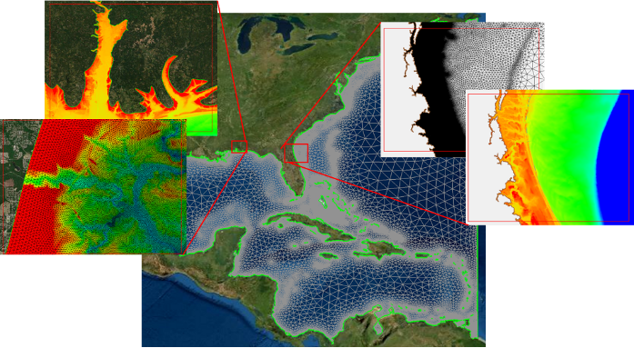
ADCIRC is a hydrodynamic modeling technology that conducts short- and long-term simulations for water surface elevations and currents in deep oceans,
CHL Model Image
Model Category
Description
ADCIRC is a hydrodynamic modeling technology that conducts short- and long-term simulations for water surface elevations and currents in deep oceans,
CHL Model Image
Coastal Modeling System (CMS)
Model Category
Description
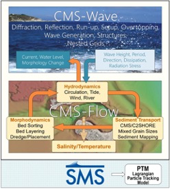
The CMS is an integrated depth-averaged (2D) numerical modeling system. Two major components of the CMS are the CMS-Flow and CMS-Wave models. CMS-Flow
CHL Model Image
Model Category
Description
The CMS is an integrated depth-averaged (2D) numerical modeling system. Two major components of the CMS are the CMS-Flow and CMS-Wave models. CMS-Flow
CHL Model Image
Sediment Budget Analysis System (SBAS)
Model Category
Description
The Sediment Budget Analysis System (SBAS) is an ArcGIS toolbox for creating and visualizing sediment budgets. Sediment budgets provide a conceptual a
CHL Model Image
Model Category
Description
The Sediment Budget Analysis System (SBAS) is an ArcGIS toolbox for creating and visualizing sediment budgets. Sediment budgets provide a conceptual a
CHL Model Image
FUlly Nonlinear WAVE model - Total Variation Diminishing (FUNWAVE-TVD) Model
Model Category
Description
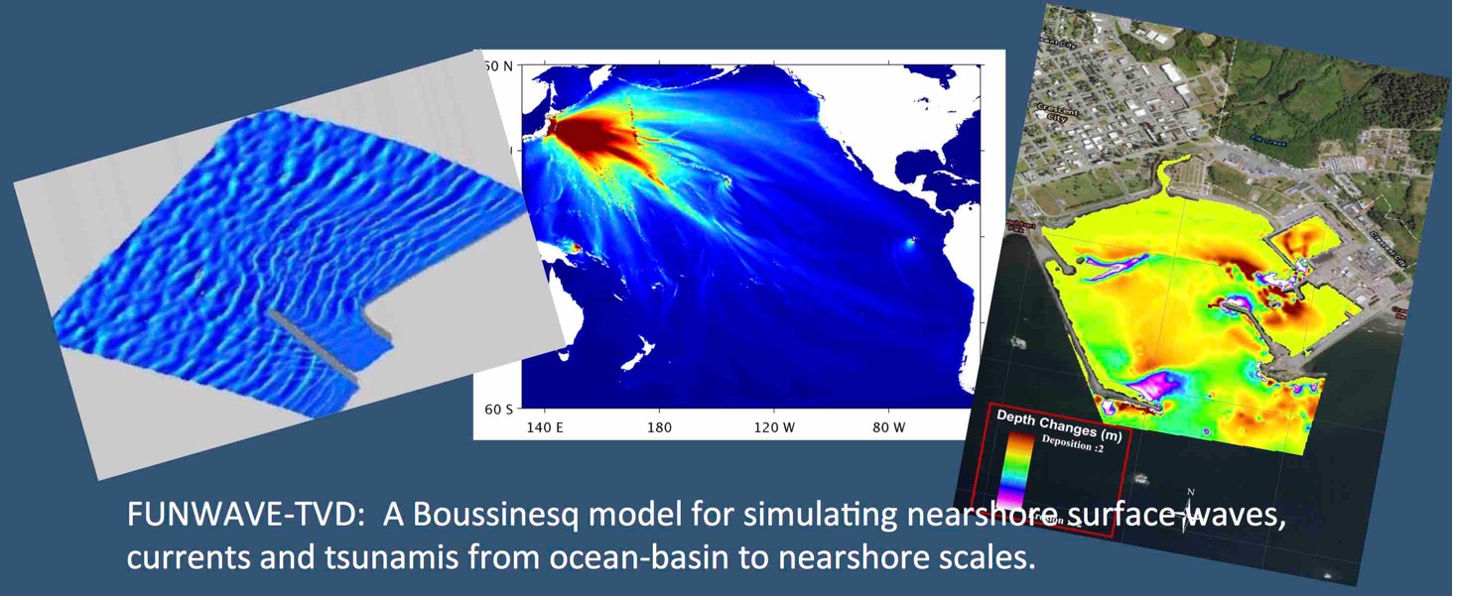
FUNWAVE–TVD is the Total Variation Diminishing (TVD) version of the fully nonlinear Boussinesq wave model (FUNWAVE) developed by Shi et al. (2012). Th
CHL Model Image
Model Category
Description
FUNWAVE–TVD is the Total Variation Diminishing (TVD) version of the fully nonlinear Boussinesq wave model (FUNWAVE) developed by Shi et al. (2012). Th
CHL Model Image
WAVEWATCH III® (WW3)
Model Category
Description
WAVEWATCH III® is a community wave modeling framework that includes the latest scientific advancements in the field of wind-wave modeling and dynamics
CHL Model Image
Model Category
Description
WAVEWATCH III® is a community wave modeling framework that includes the latest scientific advancements in the field of wind-wave modeling and dynamics
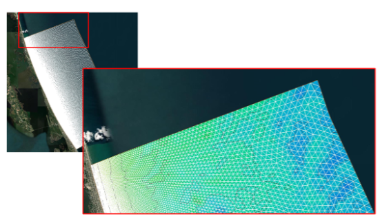
CHL Model Image
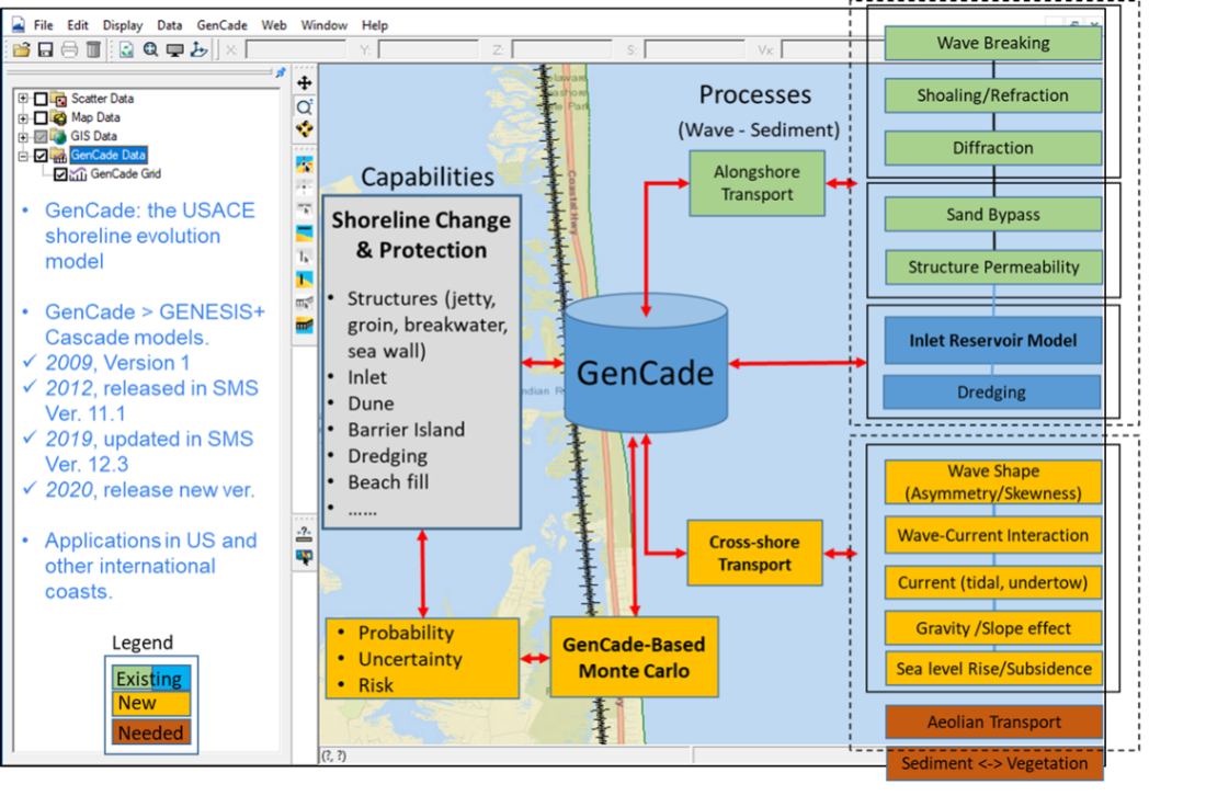
GenCade - A Regional Shoreline Evolution Model
Model Category
Description
GenCade is a one-line shoreline simulation model that combines the capabilities of regional-scale, planning-level calculations of the Cascade model an
CHL Model Image
Model Category
Description
GenCade is a one-line shoreline simulation model that combines the capabilities of regional-scale, planning-level calculations of the Cascade model an