
CHL Model Image
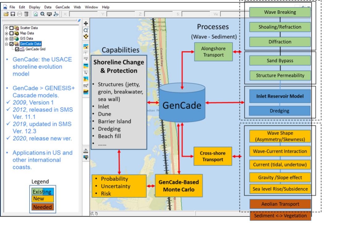
GenCade - A Regional Shoreline Evolution Model
Model Category
Description
GenCade is a one-line shoreline simulation model that combines the capabilities of regional-scale, planning-level calculations of the Cascade model an
CHL Model Image
Model Category
Description
GenCade is a one-line shoreline simulation model that combines the capabilities of regional-scale, planning-level calculations of the Cascade model an
CHL Model Image
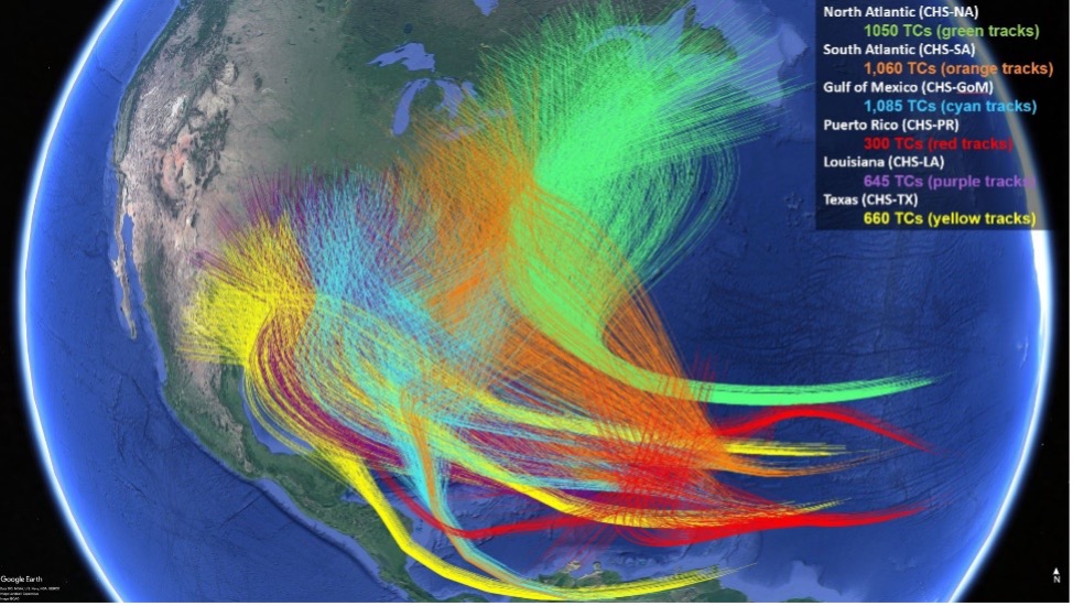
Coastal Hazards System (CHS)
Model Category
Description
The Coastal Hazards System (CHS) (https://chs.erdc.dren.mil) is a national-scale, multi-agency initiative for quantifying coastal hazards from hurrica
CHL Model Image
Model Category
Description
The Coastal Hazards System (CHS) (https://chs.erdc.dren.mil) is a national-scale, multi-agency initiative for quantifying coastal hazards from hurrica
CHL Model Image
Adaptive Hydraulics (AdH) Model
Description
Adaptive Hydraulics (AdH) is a modern, multi-dimensional modeling system for saturated and unsaturated groundwater, overland flow, three-dimensional N
CHL Model Image
Model Category
Description
Adaptive Hydraulics (AdH) is a modern, multi-dimensional modeling system for saturated and unsaturated groundwater, overland flow, three-dimensional N
CHL Model Image

Surface-water Modeling System (SMS)
Description
The Surface-water Modeling System (SMS), developed by Aquaveo, LLC, gives users access to a full range of coastal and riverine solutions. It provides
CHL Model Image
Model Category
Description
The Surface-water Modeling System (SMS), developed by Aquaveo, LLC, gives users access to a full range of coastal and riverine solutions. It provides
CHL Model Image
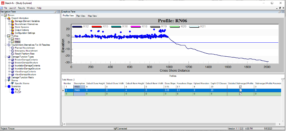
Generation 2 Coastal Risk Model (G2CRM)
Model Category
Description
G2CRM is a probabilistic life cycle analysis model for evaluating performance and economic benefits of inundation prevention measures for coastal stor
CHL Model Image
Model Category
Description
G2CRM is a probabilistic life cycle analysis model for evaluating performance and economic benefits of inundation prevention measures for coastal stor
CHL Model Image

Watershed Modeling System (WMS)
Model Category
Description
WMS is a graphical user interface (GUI) used in the development of inputs and visualization of outputs for watershed, hydraulic, and storm drain model
CHL Model Image
Model Category
Description
WMS is a graphical user interface (GUI) used in the development of inputs and visualization of outputs for watershed, hydraulic, and storm drain model